|
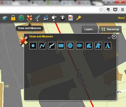
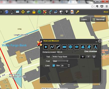
Draw and Measure Allows the user to
annotate their map with drawing and tagging tools, and also add text. Select appropriate
tool to markup the map (point, line, polygon or text. Click on any map
location to start your drawing, follow the onscreen prompts, and (if
appropriate) finish by double clicking.
Optionally, you can select to calculate and display the measurements
of length and area by selecting the “Show Measurements” checkbox. |
|
|
Examples |
|